 Filter: Categories of Wisconsin Historical Images
Filter: FORMAT_DIMENSIONS of 45 x 54 cm.
Filter: Categories of Wisconsin Historical Images
Filter: FORMAT_DIMENSIONS of 45 x 54 cm.

| Date: | |
|---|---|
| Description: | A map of the western Upper Peninsula of Michigan and Wisconsin north of Lake Winnebago and east of Lake Pepin and the mouth of the Saint Louis River on Lak... |

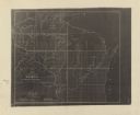
| Date: | 07 07 1915 |
|---|---|
| Description: | Ink on tracing cloth. Includes signed certifications from the surveyor, notary public, and Wisconsin Realty Company. From the E.P. Sherry papers relating t... |

| Date: | 1961 |
|---|---|
| Description: | This map shows wards as well as proposed future streets, lot and block numbers, additions, and some landownership. The Sheboygan River is labeled. |
| Date: | 1852 |
|---|---|
| Description: | This map shows township grid with survey progress, military posts, areas of Indian habitation, cession areas, and treaty lines. Shows the entire state of W... |
If you didn't find the material you searched for, our Library Reference Staff can help.
Call our reference desk at 608-264-6535 or email us at: